Trailhead GPS Coordinates and Directions

Piney Dam Trailhead: 41°10’30.24″N 79°26’54.62″W

From I80, head South on Rt-68. Approximately .07miles turn right onto Piney Dam Road. After road turns to gravel and narrows, turn left and go over bridge following road around to the left. Trailhead is there on your left.

Limestone Trailhead: 41°7’40.84″N 79°19’5.65″W

From I80, head South on Rt.-66. Approximately 4 miles turn right onto Limestone Road. Trailhead is approximately 1/4 mile on the right.

Piney Rail Trail map is downloadable on the following:
Lifetime Trail Maps
onX Offroad
Polaris Ride Command

download map (PNG Format)

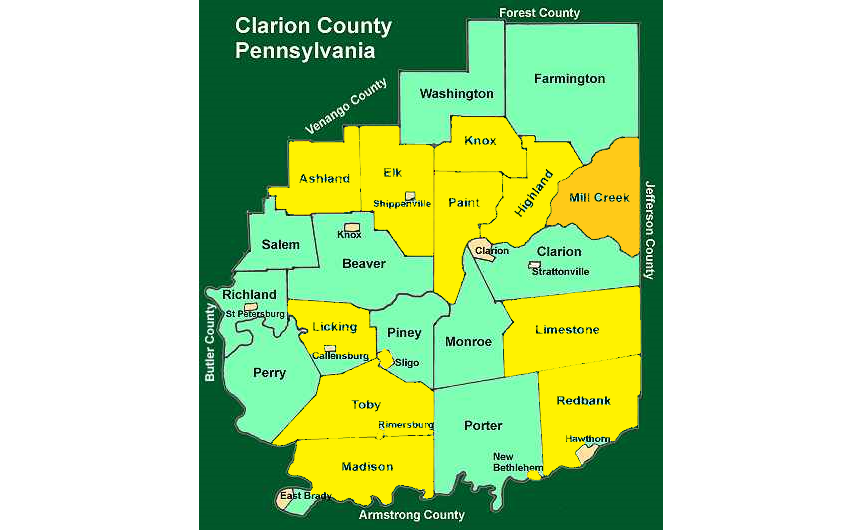
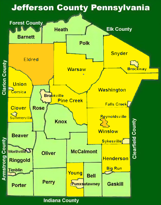
ATV Friendly Townships

Always double check with each individual township to see if a permit is required. Certain permit information is found below.

Townships highlighted in bright yellow DO NOT REQUIRE PERMITS. Townships highlighted in gold DO REQUIRE PERMITS.

Your Piney Rail Riders Membership DOES NOT include any Township Permits, it only includes the trail itself.

Updated 5/7/2024

Eldred Township ATV Permit Application

2024 Eldred Twp ATV Rules-Regulations-Map (pdf)

Download

2024 Eldred Township ATV Permit Application (pdf)

Download

Reynoldsville Borough ATV Permit Application

2024 Reynoldsville ATV Permit (pdf)

Download

Millcreek Township ATV Permit Application

Millcreek Township ATV Permit (pdf)

Download

Millcreek ATV Operating and Road Use Rule Sheet (pdf)

Download

Millcreek ATV Rules and Regulations (pdf)

Download